


SloveniaHolidays.com > Attività > Ovča koča
Ovča koča


punto di partenza: : Zgornja Kokra
- lunghezza:
34.0 km - tempo:
03:00:00 - difficolta:
media - fondo:
asfalto, strada di bosco, sentiero - Differenza di altitudine:
740 m
Descrizione della strada
From the Lehajnar inn (600 meters above sea level) in Zg. Kokra we begin a moderately difficult ascent along an asphalt road in the direction of Jezersko. Soon, the road becomes level. We continue past the sign Občina Jezersko and the Kanonir inn (a little past the sign, on the left). From there we take a slowly ascending route to the sign saying Jezersko. A steeper ascent follows. We bicycle along several bends, past a chapel on the left and to the hotel Jezersko in Zg. Jezersko (880m above sea level). Just before the hotel we turn right and take a narrow asphalt road in the direction of the Kočna mountain. At first, the road descends for a short moment, but a steep incline follows (V4). Soon the road becomes somewhat less steep.We ride to the end of the asphalt road and to an intersection at the lower station of an abandoned ski lift. Here, we turn right (the road on the left leads to the Makek farm), in the direction of the arrow pointing to V. Vrh. We follow an occasionally steep, not very well marked forest road to the upper station of the ski lift (1090m). From there, the route becomes very steep and takes us past a marked road leading to V. Vrh. We ascend further up several difficult inclines (V4) until the road levels out at a typical left bend (1250m) by a sandy cutting. Here, we turn left and continue up along a narrow and not very well maintained dirt track. Several short, steep, up to extremely difficult slopes (V5-V6) follow, interspersed by occasional level areas. Eventually we arrive to a hunting cottage (1340m) on the Ovča koča mountain. We descend back to Zg. Kokra back along the route by which we ascended.
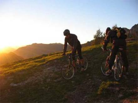
This is a diverse route with several good views of the peaks of the Karavanke and Kamniške Alpe mountain ranges.
AVVISO:
Per la descrizione delle strade ciclabili, puntualita' e precisione dei dati l'autore di questa pagina non si assume nessuna responsabilita'. Le strade ciclabili le abbiamo presentate nella maniera migliore possibile. La valutazione per la realizzazione del giro e' soggettiva per ognuno che lo realizza o legge queste pagine. Il decreto della corsa nell'ambiente naturale (UR. l. RS 16,28/95)